Engineering
Solutions
Cost-Management through the Engineering Lifecycle
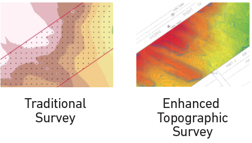
Cost management is integral to any engineering or construction project. Phases throughout project’s development require consistent, timely and reliable information from across the site; to make the correct decisions, mitigate risk, and maximise investment in the project. These costs are typically magnified when a project takes place within a remote or inaccessible area, making the provision of reliable data and analytics to remote teams, critical.
Over 30 Years of Experience
Our field teams have over 30 years of experience operating in the Canadian bush. Originally building our business on mapping forest inventories for the Province of Ontario, our core expertise is in photogrammetry and mapping. In addition to experienced in-house UAV operations teams, our staff includes professional remote sensing analysts, land surveyors, environmental science specialists and statisticians.
Wenscott Developments
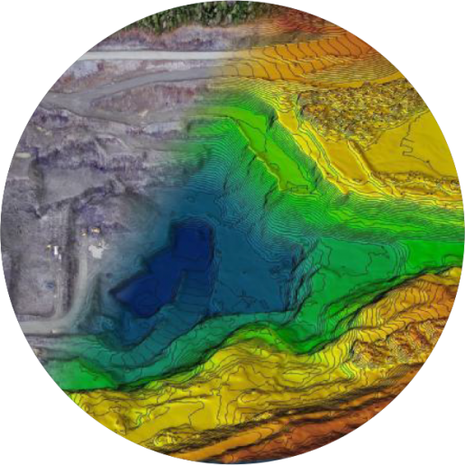
When Wenscott Developments needed to assess bedrock and drainage structure while planning their subdivision, Sumac was able to combine UAV data with geotechnical survey information to reveal surprising, cost-saving insights leading to a revised building structure.
Browse by Sector
Geospatial Insights with Pinpoint Accuracy
Sumac’s experienced GIS and Geomatics personnel are ready to take on your next project.
Our team of skilled professionals deliver comprehensive information solutions on-time, within budget, and to your specifications.