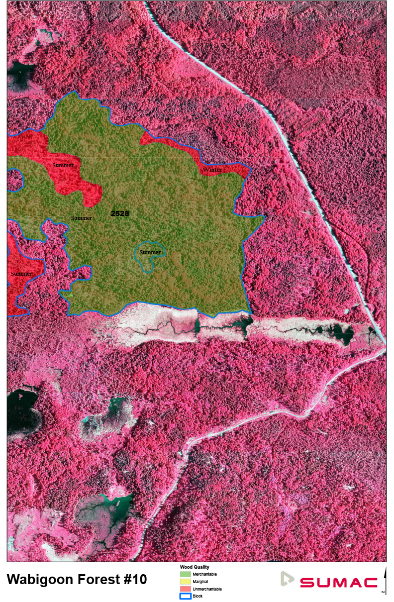
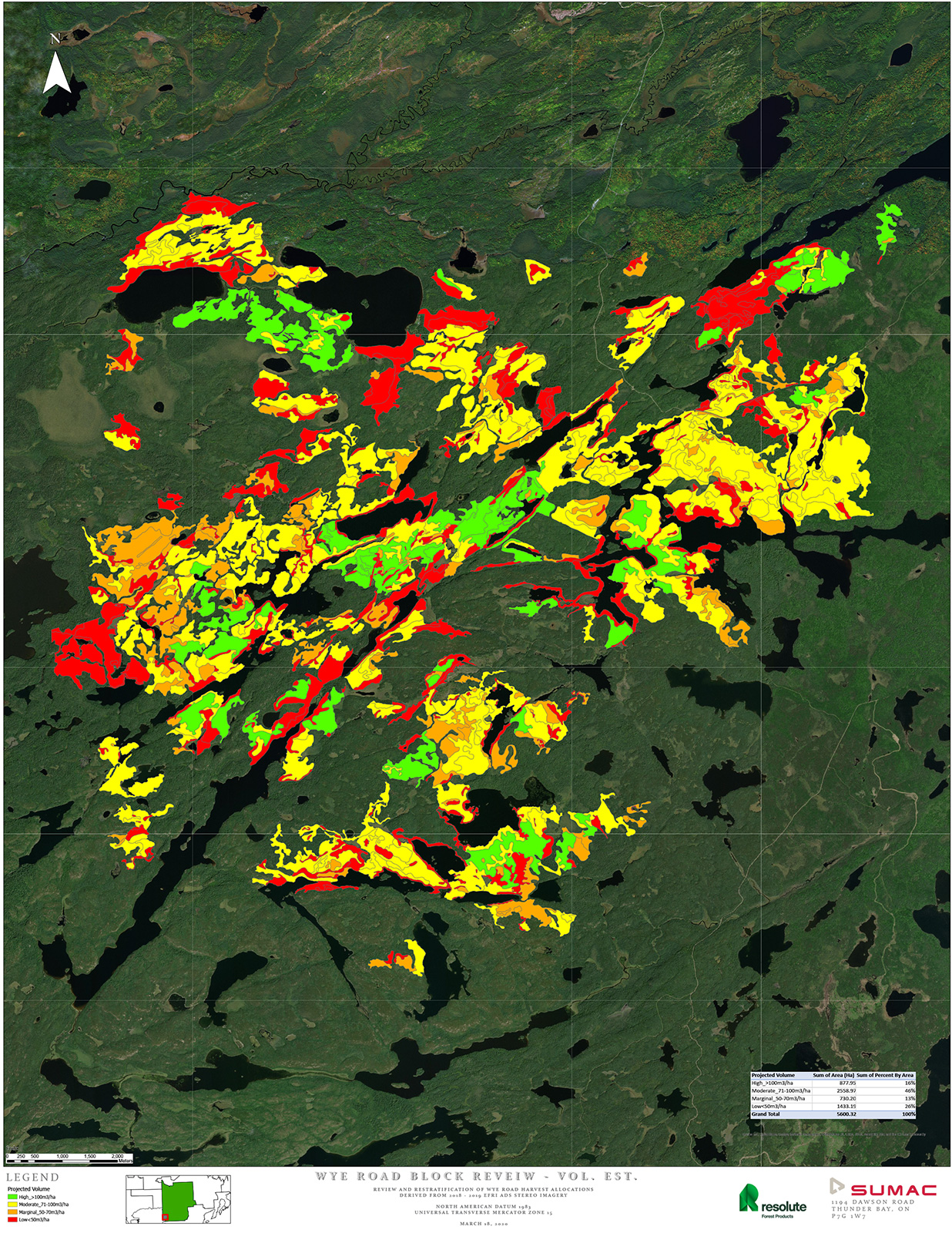
Over the past 24 months, Sumac team of highly skilled air photo interpreters have complete harvest block level assessments of several Forest Management Plans in Northwestern Ontario. Projects have included the Boundary Waters Forest (Crossroute and Sapawe), Dryden Forest, Red Lake Forest and Wabigoon Forest. Using high resolution 40cm ADS imagery, interpreters assess and classify blocks for a range of conditions:
Operability (terrain, access)
Marketability (Sawlog(s), pulpwood, other products)
Merchantability (volume, height, age)
About Our Company
Sumac provides high resolution remote sensing, survey and inventory solutions to assist companies who need answers to spatial questions.
