Mining
Services
Reducing risk and increasing profits, throughout the mining lifecycle
Mining operations are driven by intelligence and analytics. Phases throughout a mine’s lifecycle require consistent, timely and reliable information from across the site; to make the correct decisions, mitigate risk, and maximise investment in the claim or operation.
Exploration and Feasibility
After building our business on mapping forest inventories for the Province of Ontario, our reputation is now in the core expertise that we provide in providing photogrammetry and mapping deliverables.
We invest in new technologies, such as unmanned aerial vehicles (UAVs or drones) and cutting-edge sensors such as magnetometers and lidar, for collecting mapping data efficiently across remote areas. These are some of the tools that we use, but we offer far more than just being a drone company. Our field teams have over 30 years of experience operating in the Canadian bush.
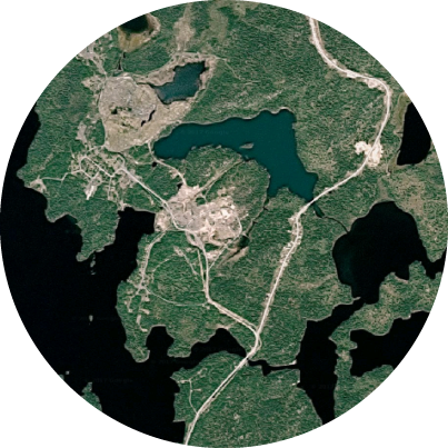
South Bay Mine
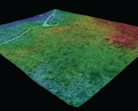
For this derelict and overgrown former mine site, Sumac Geomatics produced high-resolution orthophotography, Digital Survey Model (DSMs), and topographic contours to assist rehabilitation work.
Browse by Sector
Geospatial Insights with Pinpoint Accuracy
Sumac’s experienced GIS and Geomatics personnel are ready to take on your next project.
Our team of skilled professionals deliver comprehensive information solutions on-time, within budget, and to your specifications.